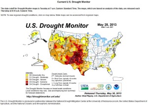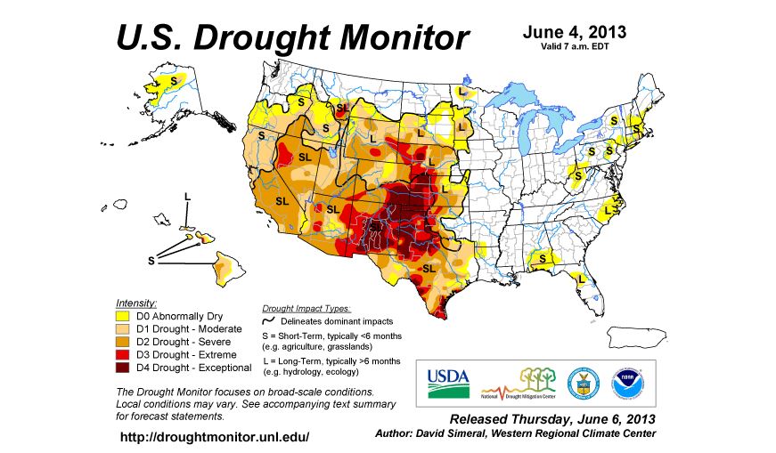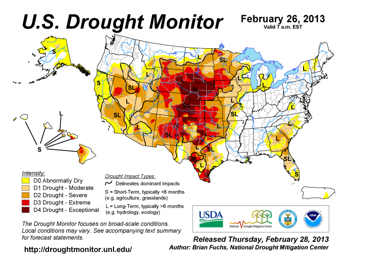
November Snow is not that unusual for parts of the midwest, and is expected anytime we get closer to Halloween. The most interesting winters involve a snow event in November, as it makes for difficult and early winter starts in the Midwest. Colder than usual temperatures in the early parts of winter, create a longer span to the next growing season in the midwest, and also, ready the soil for freezing and better acceptance of more accumulated snow depths. In 2013, we have had a slow to start spring in the midwest of the United States. This created a wet pattern, that continued all the way to the end of July of 2013. With increase of heat and higher temperatures, we saw a small drought occur in August and September of 2013, with a quick rebound to precipitation in October of 2013.
November Snow is Predicted for Early
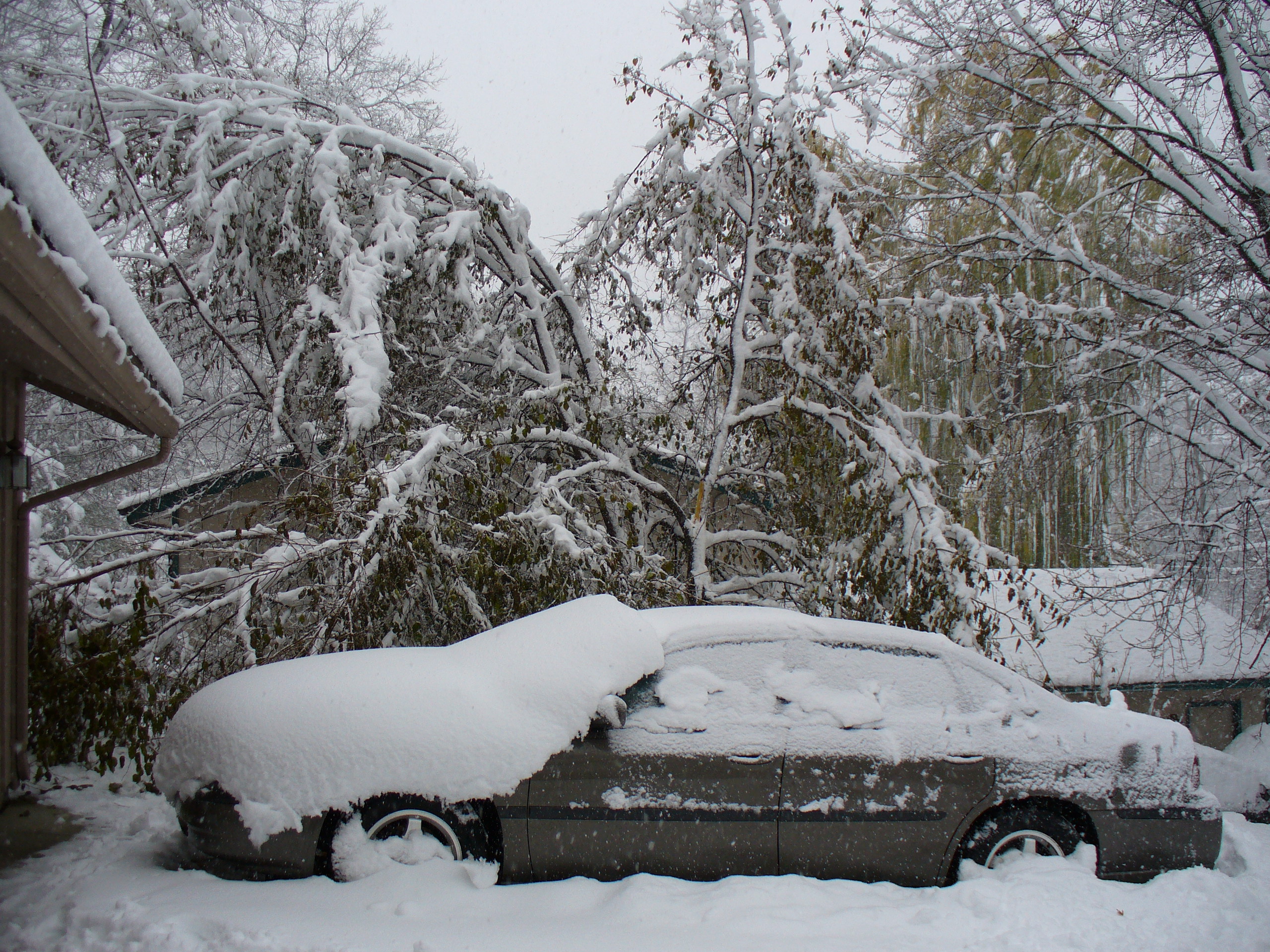
November 2010 Snowfall With Over a Foot of Wet Snow
Although the first snow seen in the midwest is often flurry activity, this winter is proving to be more anxious to show itself, and the first event in the middle parts of South Dakota, Minnesota, and Wisconsin should increase chances around November 6th or later. The ever constant in this pattern, is the lower bump to the jetstream, which seems to be dipping into parts of Middle America. November snow is increasingly seen as a norm of precipitation all the way into the middle parts of the country, as this colder than normal variance, is the pattern.
November Snow Will Start as Rain
Often daytime temperatures will improve to close to 50 degrees around November, with a sunny sky. The only heating event that is possible during November is a sunny day, and frequently November is mostly cloudy. November Snow will begin in the midwest as rainfall, when they begin during the daylight hours, as even a glimmer of daylight can create a higher temperature than during the nighttime. With the increase of colder temperatures, the swing of the jetstream to this very curvy pattern, the chances of a November Snow of more than 5 inches is very possible. And, when the jetstream evens its way out, to a more stream like pattern, and less of a wind event, we will see the increase of new higher temperatures and daytime heating to occur. When sun is expected, less available moisture and chance of cold will create a break in the possibly of November Snow.
November Snow will Extend the 2014 Winter Season
Why does the november snow event often show a longer chance for a more wintery precipitation period? Often when we see an increase of snow early in the winter season, it means there is a greater chance for more snow, better chances for precipitation to build up as snowfall, and temperatures stay cooler. A colder and snowy period is in store for the midwest this season, making for colder soil temperatures, a chance for lakes and water bodies to freeze quickly, and for lots of trees to be vulnerable due to quick storms. With wet heavy snow, power outages could be a possibility, and the trees in the midwest are just really getting used to dropping their leaves as of November 1st, 2013. Not many trees have dropped, even with gusty winds and frequent rain events. Over half of the trees have yet to drop their leaves, making november snow even more hazardous than a december snow event.